
Orbis Navigator... because The Earth is not flat!
Welcome! Let us present to you the highlights of Orbis Navigator - the mobile map viewer, navigator, position recorder and ... much more than that!
One can't say Orbis Navigator has just one of those purposes. Orbis is travelling assistant. It is designed so that you may rely on it from the start of journey until its end.
And last but not least, it's nearly free!


Three-dimensional map
Multifunctional, interactive map is the key feature of Orbis. The map is
three-dimensional, and is surrounded by many supportive functions. Read more about
the map and its functions in general information
or help.

Simple, reliable and clearly arranged navigation
One of the functionalities of the map is the navigator. It obtains directions
from the XYZ server. Read more about navigation in Orbis in
help.

Viewer and analyzer of planned or finished trips
This tool provides you a way to review and possible analyze your trip.
It shows altitude profile of the trip (on its chart, you may even
mark a part of the trip that specifically interests you. And beneath
the chart, there are several overall data. Read more about track analyzer
in help.

Computer providing GPS and track data
A tool providing the look at current data - both from GPS and from data logs.
Read more about computer in general information or help.
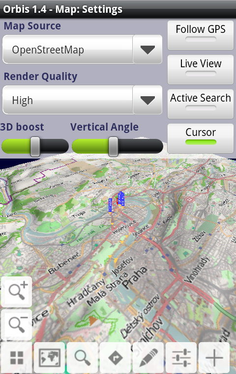
Map layout and behaviour adaptable to your liking
As the map has flexible handling and way it is rendered, you may customize
it in settings. Map rotating according to the accelerometer or compass, the
quality or source of map, and several others. Read about map settings
in detail in help.

Complex POIs search based on broad range of criteria
The screenshot of specifying search parameters. Read more about
possibilities of searching in help.

Preview Google StreetView or images for given position
The screenshot of specifying search parameters. Read more about
possibilities of searching in help.
Continuous position tracking
Since position tracking is a very natural and frequently used feature
in every navigation application, Orbis performs tracking continuously,
not forcing you to turn it on explicitely.

Offline maps
As the map has flexible handling and way it is rendered, you may customize
it in settings. Map rotating according to the accelerometer or compass, the
quality or source of map, and several others. Read about map settings
in detail in help.

Weather forecast
Orbis provides you weather forecast for any location
from the Internet. Read about obtaining weather forecast with Orbis
in detail in help.